When the Tonle Sap River Turns
A single arrow cannot describe the water between Cambodia’s Great Lake and the Mekong. The direction changes as the wet season fills the lake and its floodplain.
In this story 4 sections
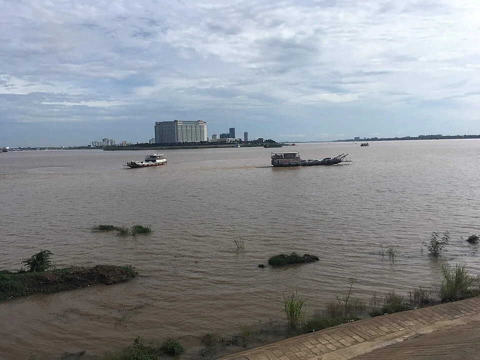
The photograph of two channels at Phnom Penh gives away very little about which direction the water is moving. The bank makes one edge easy to follow. There is another trace beyond the first, and a great deal of water in between. Traffic and wind can put convincing little marks on the surface. A drawing made from this view might label the Tonle Sap River and the Mekong and leave the names to settle the geography. It is a perfectly usable picture until someone asks which way to draw the arrow in the first of those channels.
For part of the year the Great Lake, or Tonle Sap Lake, sends water down the Tonle Sap River toward the Mekong. In the wet part of the year, sufficiently high conditions on the Mekong change the direction of the river and send water toward the lake. The Mekong River Commission describes both stages and the much greater extent of the lake and flooded land at high water. An apparently stable junction belongs to a changing system far beyond the edge of the picture. The other half of the map is a season.
Keep the lake and the river separate
Names can encourage an easy mistake. Tonle Sap Lake and the Tonle Sap River are connected, and a description can use “Tonle Sap” for a broader system that includes both. If the question concerns direction, mark them separately. Place the large lake inland on your sketch, and then extend the connecting channel toward the Mekong at Phnom Penh. The lake has its own tributary inputs and surrounding land. The channel is the route through which it exchanges water with the larger river. Observing a bank of the lake is not the same thing as measuring how much water is moving through the link.
An arrow drawn toward the Mekong can look as though it is part of the line you drew for the channel. Use one sheet to hold the line and two separate sheets for the arrows. On the first, show water leaving the lake through the connecting river when the dry-season pattern is in place. On the second, mark the opposite direction during the high-flow period. Set the two diagrams side by side. Nothing in the name or permanent position of the channel had to change for the diagrams to represent different conditions. You do not need to redraw the junction to take account of a new direction.
This distinction is particularly useful when asking where a particular piece of land falls in the system. At low water the margins of the lake occupy one position. At higher water another stretch of ground can become part of the wet area. One map features a very stable outlet; another is drawn to show the area of land the water can reach. Each can omit useful things if it was made for the other question. That is a stronger distinction than labeling one map modern and the other one old.
A small difference in level can reach a long way
The direction of flow in the connection is related to conditions across the system. Think about a pair of connected basins. If water rises farther on one side, there can be a sustained tendency for it to move toward the side with a lower surface. In the case of the Tonle Sap River, the Mekong’s seasonal rise can raise levels enough for water to travel toward the lake. As the conditions shift again, the lake and flooded land can drain back toward the Mekong. The basins are only a comparison for the significance of water levels. An actual river system has moving water, irregular terrain and changes along its length that a pair of vessels cannot reproduce.
To sketch that properly, draw a separate profile instead of placing all the weight on the overhead map. Put one measure of approximate level at each end and think about the difference between them. The point at which the main river starts to rise need not be the moment the connecting river settles into a sustained reversal. The position of the lake’s surface matters as well. A report about reversal dates has to say where and how the change was recognized. Two observations close in time do not necessarily disagree if they describe different things or sites.
The word upstream can get particularly awkward in conversation. Someone who describes the same position using fixed familiar place names may sound as if they are disagreeing with a person locating it by the direction the water was moving that week. A clear account names the places, states the current direction in the connection, and gives the time of the observation. “Toward the lake” keeps its meaning across the two seasonal diagrams better than an isolated claim of “upstream.” The simpler expression also makes it possible for interested people who have never visited the confluence to put the observation on a map.
Flooding is part of the geography
The Mekong River Commission describes a severalfold increase in the lake’s surface area between approximate low and peak conditions. The extra water is not held inside a sharply walled bowl. It spreads into surrounding low ground. This involves two different kinds of change: how deep some water becomes and where water is present at all. A single number describing the level cannot be converted to a map of the flooded area without knowing the shape of the land. A small rise on very flat ground can reach a great deal farther from the existing edge than the same rise against a steep bank.
Follow one hypothetical route that leads to the lake. A point that was a considerable walk from water in one season might stand quite differently in relation to shallow flooded ground in another. That can affect transport, the timing of work and the lives of animals and plants in the surrounding system. The effect cannot be reduced to the inconvenience of having a high river at a particular house. The annual motion of water gives people and ecosystems periods in which different ground is available for use. The official description links that flood cycle to biodiversity and local livelihoods.
The duration of the high condition also matters. Imagine two seasons in which a measurement reaches approximately the same maximum. In the first, water remains high for a long time. In the second it rises and falls comparatively rapidly. There may be a similar broad extent visible at one moment even though conditions on the surrounding ground have not been the same over the weeks. A still photograph and a chart of a maximum can both be accurate and still miss the difference. A series with a time axis makes room for more of what people and other living things experience.
The commission’s procedures make a place for the reverse flow alongside other basin conditions. Whatever use is made of those procedures, their existence helps illustrate why a season is more specific than a pair of arrows. A record useful for comparison across years must say something about when the direction changed and how well the connection actually supplied the lake. A short event can have the same direction as a long one without moving the same volume.
Try reading a year’s sequence with only the calendar exposed at first. Mark the beginning of the high water at one site and then reveal the record from the connection. Look for where the dates match and where they do not. A mark next to a date in a report may apply to a defined measurement point rather than every place around the lake.
Use the photograph and records for different questions
At the confluence, water reflecting a bright sky can seem to advertise movement in the direction of its longest bright stripe. Surface material, changes in wind, waves from vessels and the perspective of the camera can confuse that judgment. A recognizable bend or junction can tell you where the photographer stood without telling you where the bulk of the water was going at the time. If the directional claim matters, look for a dated measurement or a report about the period. A photographer’s view supplies context the record of levels cannot replace. It should not have to stand in for the measurements.
Make notes on a series with as little mixing as possible. A level reported on the Mekong and the observed direction of flow through the connecting river are related but different. Report each with its site and date. If possible, distinguish where an area of flooded ground was observed from where it was estimated from levels. Should the two series cover different days, leave the break visible. A neatly matched pair of maps can be very persuasive while quietly assigning one condition to the wrong moment.
A final exercise is to redraw the two arrows without changing the outline of the lake. Then draw the changed outline in a different color. You now have three related things on the page: which route the link takes, which direction it carries water in, and what can happen to the area at one end of it over time. The photograph from the city may not tell you which arrow to use on its own. It does record a place at which those larger changes can be connected to a familiar bank and a piece of water stretching across the view.