Two Raindrops on Opposite Sides of a Divide
A divide that takes one step to cross can send surface water toward different rivers. Start with the place where the water leaves, then trace back uphill.
In this story 7 sections
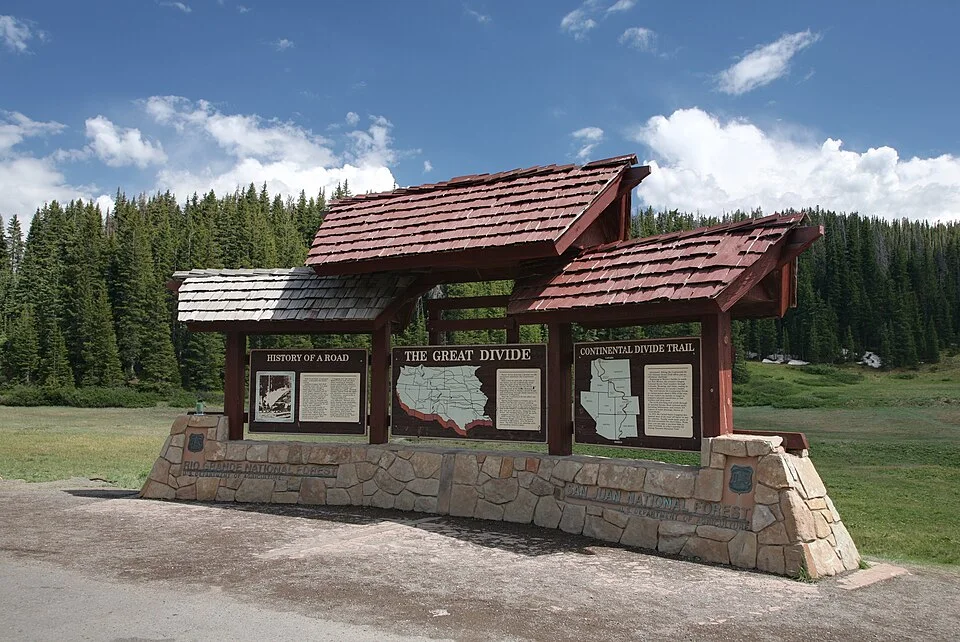
At a mountain pass, a road can cross a boundary without a gate. A raindrop falling on one side may begin moving toward one stream. Another drop falling a few steps away can run toward a different one. A sign on a famous divide can make that change dramatic. The same separation can happen on a quiet ridge between two neighbourhood creeks. Scale does not change the essential idea, although it changes how the boundary is represented.
Name the outlet before drawing the boundary
A watershed gathers water toward an outlet. The outlet might be a point on a stream, the downstream end of a reservoir or the place where a river reaches a bay. Move that point upstream and some land that was inside the first watershed will fall outside the new one. There are small catchments inside large ones. They describe how particular pieces of the drainage system work together rather than establishing a single correct size for a watershed.
To build a model, put an imaginary gauge just below the place where two streams meet. Each stream has its own feeder area. Both contribute at the gauge. Move the gauge above the meeting point on only one branch. The other branch no longer passes through that spot. The hills have not moved; the question has. Maps with different subdivisions can therefore both be right while using the same terrain.
Look at the shape of the high ground
On a map with elevation contours, find the valley that contains a tributary and then the higher ground on either side. Nearby contour lines often form a bend that can help distinguish a valley from a slope dropping away on both sides. Use the printed elevations to confirm the direction; a shape by itself is easy to interpret backwards. Follow the ridge toward the next piece of high ground. The line you are looking for stays between areas that send surface water toward different outlets. It is not supposed to trace the easiest route a walker could take.
The idealised line can be harder to identify over very flat ground. The contours may be too widely spaced to show the shallow depressions that determine drainage. Roads, culverts, ditches and other works can move some of the water somewhere the natural slope would not send it. Underground movement can also differ from surface drainage. A map is useful when it tells you which kind of movement its boundaries describe and how those boundaries were drawn.
See who shares the same downstream point
Imagine a school, a sports field and a small tributary on the same street map. The street arrangement can make them seem closely related while a slight rise sends runoff from each toward a different drain. A contour map offers a beginning for that comparison. A map of drainage infrastructure, where publicly available, can help tell you where water actually continues once it has entered a pipe. The same question can be answered at a broad scale for an entire river basin and at a very local scale for a drain. At each scale, establish what kind of water and what boundary the account refers to.
If you are reading about water quality or flood management, put the farms, streets or slopes being discussed upstream or downstream of a named spot. A study of one tributary can be valuable without representing its entire river. Conversely, an observation downstream of several tributaries rarely indicates on its own which one delivered the material being measured. Separate the place that contributed to a flow from the place where somebody recorded it.
A divide joins and separates rather than merely marking a line. It groups places that drain together and distinguishes them from similar-looking terrain nearby. The two raindrops begin the story. Following them long enough tells you where to put the next question.
Try a change of outlet on a paper map
Pick a stream on a reliable map and follow it to a point above the junction with a second stream. Imagine putting an observer there who can see whatever water flows past. Upstream land draining to the first stream contributes to what passes the observer. Land draining to the other stream has its own way of reaching the larger waterway below that point. Move the observer to a bridge below the junction. Water from both branches now reaches the new observation point. The larger collection of contributing land follows directly from the change in the question.
This is a way to check some apparently conflicting statements about the size or scope of a drainage area. One measurement may refer to a physical gauge while the other refers to a place farther downstream. One may trace a sub-basin while another describes the whole system. Keep the outlet visible when comparing figures. Going backward from the two points can explain why parts of a map are included in one description and absent from the other. It is particularly useful where two names are used for water that continues along the same large valley.
Following an increment between stations can also suggest a better use of a measurement. If a tributary joins between two sampling points, readings in the main channel can be different even if conditions above the first point are stable. Other influences, including differences in time or conditions, can matter as well. A map helps identify the tributary as something to investigate. It does not identify a cause simply by drawing a link. Keep measurements, times and possible sources together as the evidence is developed.
Water can be stored or diverted on the way
The easy diagram sends every raindrop downhill to the outlet as soon as it lands. Real ground can hold a portion of the water, and it can take a while for some of that portion to reach a stream. Plants return water to the air, and water can pass into soil and movement underground. The USGS account includes some of those routes when explaining how water travels through a basin. It is helpful to distinguish a boundary for surface runoff from an estimate of what portion of a storm will be observed passing a particular point at a particular time. These are related questions with different evidence.
An altered landscape can interrupt the easy diagram too. A roadside ditch may carry water along a course whose details are difficult to see on a map designed for a large valley. A culvert can pass it under the road. Storage and drainage structures can change when water reaches the next named stream. If the field evidence contradicts an otherwise useful small-scale map, look for the feature the scale leaves out. Report the condition plainly and keep the possibility of temporary blockage or an unusual storm separate from an account of the usual route.
Follow the boundary while staying in public space
A clear public viewpoint can help identify a valley and the higher ground next to it. Mark the direction you were looking and name a couple of features you can identify on the map. A hollow that looks continuous from the path may be divided by a rise hidden behind a hedge. When the terrain is subtle, printed elevations can provide information your eye cannot. A tidy imaginary divide is less important than an honest indication of where the view gave way to interpretation.
The method can travel to any familiar neighbourhood. Start at a stream mouth, reservoir outlet or crossing where the direction of flow is known. Ask what ground can send water there, then pick one plausible contributor and see what evidence supports the link. If you change the outlet, write the new one at the top of the note. A boundary drawn around a specific question is easier to test and explain than a freehand shape attached only to the name of a river.
Some basins do not send surface water to the sea
The word outlet can suggest that every path ends at an ocean. Enclosed drainage areas offer a useful exception. Water can collect in a low area and leave mostly by processes such as evaporation or movement underground rather than by flowing through a river out of the region. Smaller streams can still gather water along the way and have catchments of their own. The broad boundary identifies the area tied to a common low destination. It does not make the destination behave like the mouth of a coastal river.
This matters when comparing approaches to the same map. An atlas intended to show continental drainage groups places by the large destination of their water. A local map for a stream can still ask which hills supply water to a bridge. One map can use the idea of an interior basin and the other the idea of an outlet for a small contributor within it. The questions differ in scale. To see whether an apparent contradiction is real, identify what the named feature would have to connect to and whether the map actually attempts to describe that connection.
The cover photograph shows a marked divide. On a walk, the sign offers a place to stop and picture two paths that would otherwise be invisible until the next storm. Try following both paths on a map after the walk. Pay the same attention to the less familiar side as to the side whose river you can already name. It may take longer to find where that water goes, which makes the boundary itself easier to appreciate.