The Shoreline That Moves Around Mont Saint Michel
In the bay around Mont Saint Michel, the place where land appears to end has an hour attached to it. Photographs describe one stage of a changing system.
In this story 6 sections
One view of Mont Saint Michel shows an island, the abbey rising above water that picks up the colour of the sky. Another shows a hill with wide reaches of exposed ground on every side. The pictures might have been taken on the same day. At low water the eye can roam across the bay without meeting the strong edge it expects to find between land and sea. When water returns, channels and gentle slopes that were easy to overlook become the most important features in the view.
A small change in height can change a large area
Draw a line across a gently sloping table and imagine water rising a little over its surface. A small rise will cover a long distance along the shallow slope. Now replace the clean surface with a flat threaded by channels. The wet area no longer expands evenly from the edge. Water can occupy one channel before it covers the surface beside it. A single distance from the abbey on a map does not describe the order of those changes.
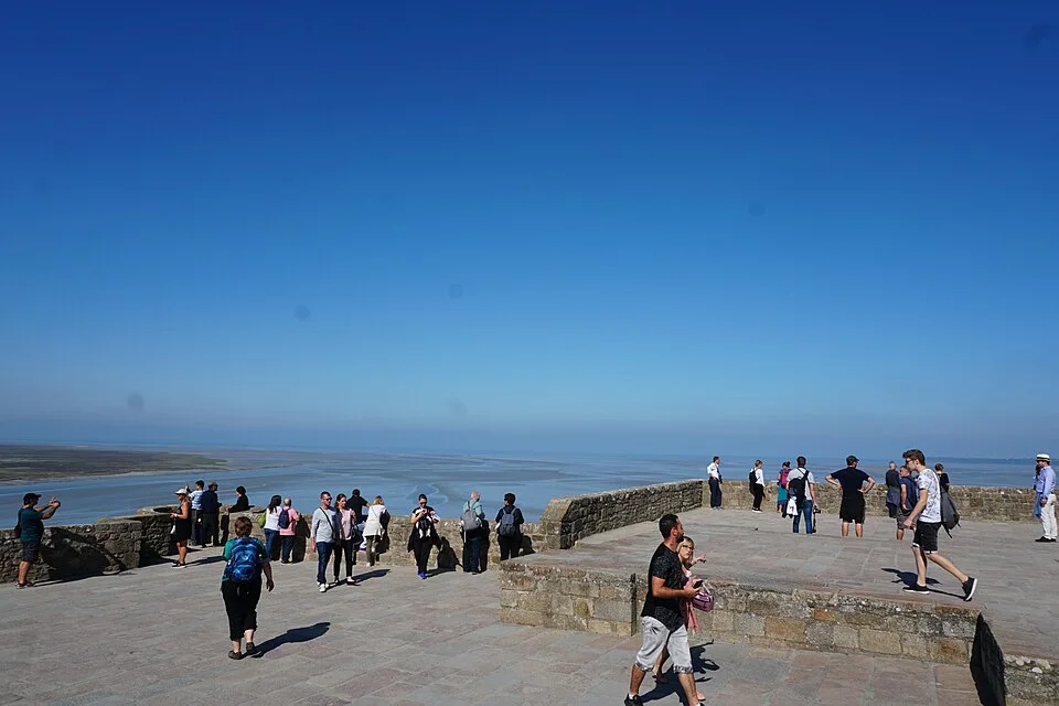
Look for the darkest lines in a low-water photograph. Some may be ripples or reflections; longer lines that connect across the flats can reveal where water still runs or stands. A view from the abbey can show their shape where a view at ground level makes the flats appear almost featureless. Conversely, height can obscure the depth of a channel. Each view describes something the other misses, and neither removes the need for local information on what happens as the tide changes.
Time belongs in the caption
If two photographs seem to disagree, first compare where the cameras were and whether the water was rising or falling. The sites of mountains and buildings have not changed between the photographs. The visible arrangement of water and exposed ground may have. Official tables show predicted times and heights. They do not show a safe route across mud or establish whether particular conditions make a guided crossing possible. Wind and local water movement may also affect what someone sees.
Read a tide table as a prediction for an identified place. Ask where the prediction applies and whether time is presented in local time. For a trip, check official access information close to your visit and use an accredited guide for any crossing of the bay. Do not use the apparent state of the flats in a photograph, even a recent one, to make a route decision. A photograph supplies the time of a view, not the conditions on every part of the bay.
The edge also shapes the view from land
Notice which part of the scene catches your attention when water is high. Reflections and the separation between the abbey and the mainland can be more distinct, while the quieter lines of channels disappear. Low water brings those lines back and supplies a better look at the shape of the ground. Neither is automatically the more revealing scene. If the question concerns the outline of the island, the higher view may be more striking. If it concerns the work done by the river and channels, the broad low-water view can give more evidence.
Read a tide table across more than one day
On a table for the bay, put a finger on the entries for high water and low water for one day. Now scan the days above and below. Both the times and the heights can change. A photograph described as taken at high tide identifies a point in a cycle, but does not tell you how much water was present compared with a different day at the same point in its cycle. A high water is high relative to nearby lower water. To know what that means for a place, you need the number, the place for which it was predicted and the reference level used to express it.
The effect becomes clearer if you think about a rock in an imaginary harbour. The first high water reaches its lower half; at another high water the rock vanishes completely. The times at which water reaches a particular ledge are therefore a separate question from the times of high water and low water. As you look across the real bay, each ridge or dip occupies a different place in this sequence. The flats in one photograph may represent ground left uncovered throughout that day’s cycle, or surface that appeared for only a brief part of it. An isolated picture cannot tell you which.
The local tourism office publishes tides with a coefficient as well as times. The coefficient helps describe the size of predicted tides in the French system. It is not the height of water at the abbey, a measure of current speed, or a guarantee that every entrance is open. An entry on the website is useful precisely because it separates some of the quantities people collapse into the phrase “big tide.” If your interest is photography, an official prediction can help you reason about a likely change in the view from a safe place. It cannot replace current advice about access.
Distinguish the sea, the river and what they carry
A visit to the island can concentrate attention on the expected return of seawater. The Couesnon also reaches the bay. Rain inland, a channel and a series of tidal changes belong to the same landscape. It can be useful to follow the darker river from a map toward the visible flats and notice where a distinct line becomes hard to find. The change in visibility does not announce the exact point at which river water stops and seawater starts. It identifies a place where the evidence supplied by a simple image becomes less adequate.
Much of what you can see at low tide reflects the travel of sediment. Fine material can move when there is enough energy in the water and settle when local conditions change. A dry-looking surface in a distant photograph can contain a mix of material with different properties. A small branch of a channel can become prominent after movement that left the broad outline of the bay familiar. That combination explains why a local guide cares about changes in the actual ground even when the same abbey, coastline and road remain easy to pick out. The large features are good anchors for a map. Smaller features tend to matter to a person moving close to them.
Human decisions can change where water and sediment move, too. Structures built to let people or vehicles reach the island can affect the connections beneath or around them. From a good vantage point, stop considering the approach only in terms of how it looks against the abbey and see where it meets the ground or leaves space underneath. It is a connection designed for people inside a larger system still occupied by water. Not every visible pattern in the bay can be attributed to one structure. The comparison at least brings the moving water back into a view often organized around the needs of an arriving visitor.
A repeatable look from the mainland
For a simple comparison on an ordinary visit, find a permitted viewpoint with a clear view of a landmark that will remain steady and at least one area of visible flats. Record the time and direction of the view. If it is convenient to return later while staying within open visitor areas, take the same view again. Include enough of the foreground to make the two photographs comparable, and keep the framing roughly stable. The exercise is a way to notice change from land, rather than a reason to follow the moving line onto the bay.
Back indoors, match landmarks before looking at the water. Compare the pieces of ground that emerged or vanished completely, then compare pieces that remained exposed but changed colour, perhaps because the surface stayed damp or the direction of light shifted. Make a separate note about shadows. An image caption can be honest about what the evidence supports: two views from approximately the same point, at identified times, with the water occupying more or less of the scene. If you know where the predicted tide applied, name it. If you do not, there is no need to put an approximate height into the caption.
When somebody else shares a view of the abbey, that small exercise helps you ask a better question than whether the image shows the island “correctly.” What moment and what direction does it show? Is the camera far enough away for the gentle slopes to be flattened by perspective? Were the changes that interest you happening in the foreground or beyond the field of view? Those questions recover parts of the landscape that a dramatic silhouette can hide.
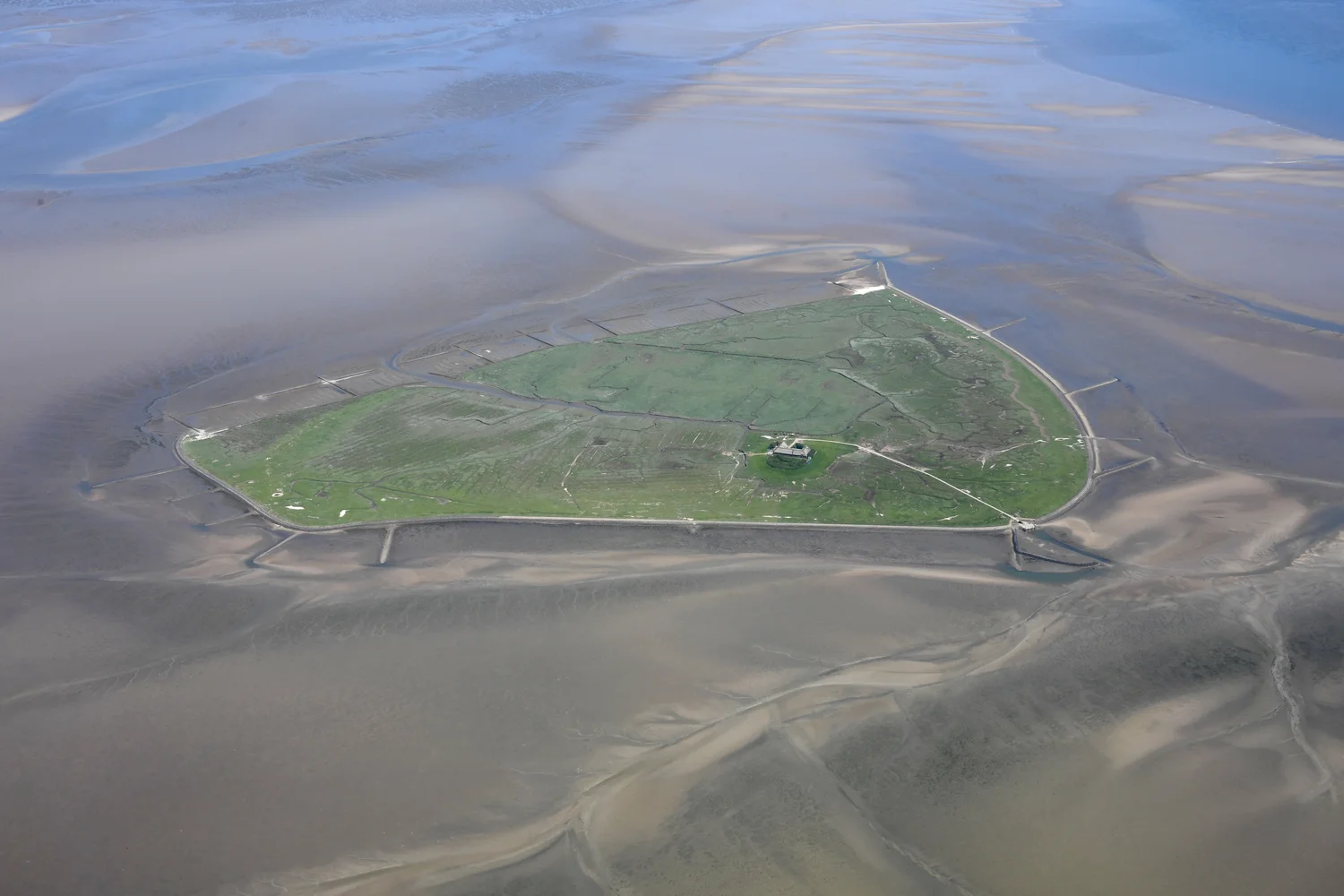
An aerial image can make a useful third comparison. Its broad field of view shows the branching shapes that a view at eye level compresses. Its drawback is the temptation to read every branch as permanent or to assume the surface is safe because it looks continuous. Check the date before treating it as a companion to photographs of another visit.
Look at any coast on a map after studying a pair of such photographs. The line that seemed obvious starts looking like an agreement made for a specific purpose. Around Mont Saint Michel, the landscape keeps reminding the viewer how much that agreement leaves out.