The Darjeeling Railway Climbs by Turning
At Batasia Loop the track takes extra distance to change height. Its course explains something a simple line between two stations leaves out.
In this story 5 sections
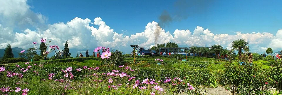
At Batasia Loop in West Bengal, plenty of things are competing to explain what the railway is doing. There is ground above the way the track first seems to go. There may be a view across the hills that would make any ordinary turn appear worth making. The rails nonetheless gave the site something more practical than a place to stop looking. A train can use a curved path to gain or lose height over more distance than a straight climb would have offered on the same piece of ground. Its progress across a map may slow or even seem to reverse while its progress in height continues.
The Darjeeling Himalayan Railway is part of the Mountain Railways of India World Heritage property. At Batasia, the railway’s path curls around itself, including a change of level. The district describes the loop in relation to the gradient of this route. What looks from above like a short return toward the part of the hill a train just passed is quite intelligible when you add a second drawing showing height. Keep both views open. On one sheet the track goes quite far to return to a familiar area. On the other it has reached a different level and can continue from there.
The train has a different measure of far
Take two made-up points at the foot of a slope and higher up on it. Suppose the needed rise between them is twenty meters. If the horizontal run available on a direct path is four hundred meters, the average grade in the example would be five percent. If a practical route can give the climb a thousand meters of horizontal run, the same overall rise gives an average of two percent. That calculation does not represent the measured grades at Batasia. It lets you see what adding path can accomplish without adding anything to the required rise.
The shape of a route matters beyond its average. A line can climb more steeply in one part and spend considerable distance changing little in another. That may give it the same average as a route that approaches a rise steadily, and a very different use for a railway. Read shorter sections of the profile if actual operating conditions are the question. A striking total distance printed beside an elevation difference is a fair starting point. It is a poor account of every load or gradient the locomotive may face between stations.
Curves impose their own demands. They need room, can affect how a vehicle moves and are part of an alignment that must fit actual ground. The solution is not simply to draw a smaller and smaller circle until it can hold any track distance in the same place. A route also needs to join the rest of the railway at appropriate positions. The valuable thing about seeing a particular loop is that the engineering choice belongs to a hill, not just to the idea of gaining extra distance in an empty landscape.
A crossing in the plan may not be a meeting
Draw the loop in overhead view and see whether one part of the route seems to cross another. Tracks could be at different levels there. An image that shows two lines from above might look like an intersection where a vehicle could choose either direction. The profile makes it possible to see why the appearance can be wrong. A line passing over the track on another portion of its journey can continue along the same overall route, at its new height. No transfer is implied by the simple crossing visible from above.
The distinction is useful when looking at photographs from the side of the loop. Part of an earlier curve can be visible while the next turn is hidden by rising ground. If the photographer is looking through a gap, several relevant edges can seem to occupy the same plane. Make a tentative sketch of the relation, then compare it with an actual view from another place or the railway’s published context. Label where you have evidence of the track and where you are merely extending it toward a point off the edge of the photograph. A convincing whole loop can be produced largely from imagination if there is no label keeping those things apart.
This is also where place names can be helpful without answering the geometry. Batasia and Ghoom help identify positions along a published route. Neither word tells you which part of a photograph runs before or after a particular turn. Pair the name with a direction of travel and a named part of the alignment where possible. A reader can then use a railway’s itinerary and a picture of the landscape together without asking one to identify every part of the other. A map printed as a line in order of stations might deliberately smooth away a very important physical curve.
The loop belongs to a longer mountain railway
The region cannot be represented by tracing the Batasia curve alone. The railway has to pass other hill shapes, buildings and open spaces along its journey. Some decisions extend over much of the line, while a particular loop makes most sense at one group of slopes. The UNESCO description belongs to this larger level of reference. Think of the loop as a case one can understand in considerable detail before asking how the entire route relates to the region. It would be odd to find the same answer necessary at every rise along it.
A sign about the railroad might give information about its history or intended use at a visitor’s position. A historian can make different use of that evidence from an engineer reconstructing the alignment. When putting such accounts together, identify which history concerns building, opening or alteration of the route, and what is visible in the picture for the date documented. Some descriptions concern services or facilities that can change. The useful point of the old loop for this story is its form, not an assurance about an individual day of operation.
It is also useful to notice the human distance that a branch of railway creates. A walk chosen to reach higher ground can take a line unavailable to a train, and a road can use a different approach. The railway must maintain its own conditions of movement. A broad view where several routes meet can be read as a collection of different requirements imposed on the same terrain. Going farther on one route may be an efficient way to arrive by its particular means. The apparent detour is worth setting onto a profile rather than being judged solely against another line on a flat map.
Two routes can cross a hill in different kinds of steps
Not every long approach has to be made as one curving loop. A railway can use a reversal at a suitable place, ending one movement and continuing in another direction along a different stretch. A loop can allow a progression around a curve without that kind of reversing move. The comparison is useful at the level of a drawing: one needs a place to change the direction of travel, while the other needs space to continue a turn. Both have to fit into the larger line with its actual gradients. Neither becomes a route merely by extending enough pencil marks to make the arithmetic work.
Railway maps are convenient guides to which solution a particular place uses. A photograph taken across Batasia can contain parts of the track, a planted interior and a train visible against the sky. The frame need not give you a view of the railway at both levels at once. Avoid putting a crossing into the history of every curve in that single view. Establish where an approach begins and how the alignment continues first.
A nearby path for people has a third purpose. It may connect open ground for a view while leaving some more direct route unavailable. Sketch it separately to show why a desirable viewpoint can exist without having to explain the operations going on along the track.
Taken together, the views can help you decide whether a part of the route passed twice through the same general area or simply crossed the same line of sight.
Keep the two drawings
Look at the track in the cover photograph and follow whichever curve is visible first. Now put the same view beside a deliberately plain elevation drawing. Where it can be seen, the track gives its curve a location and a scale among other things. The profile puts the curve back into measurable work the route needs to do. Their relationship is a useful form of orientation. You can understand the physical turn without relying on the picture to report where every part of the train has gone.
A traveler looking down might see a place passed earlier once more. Rather than treating that recurrence as wasted time, think about what the train has gained between the two views. It can continue at a different height because the line put length into the ground instead of asking the ground to be something it was not. The turn has practical value even when the viewpoint offers an extra reason many people keep looking after the train moves again.