How the Danube Delta Keeps Branching
The large named arms of the Danube help orient a map. Smaller channels, lakes and wetlands explain why there is, in practice, much more than a single route toward the sea.
In this story 5 sections
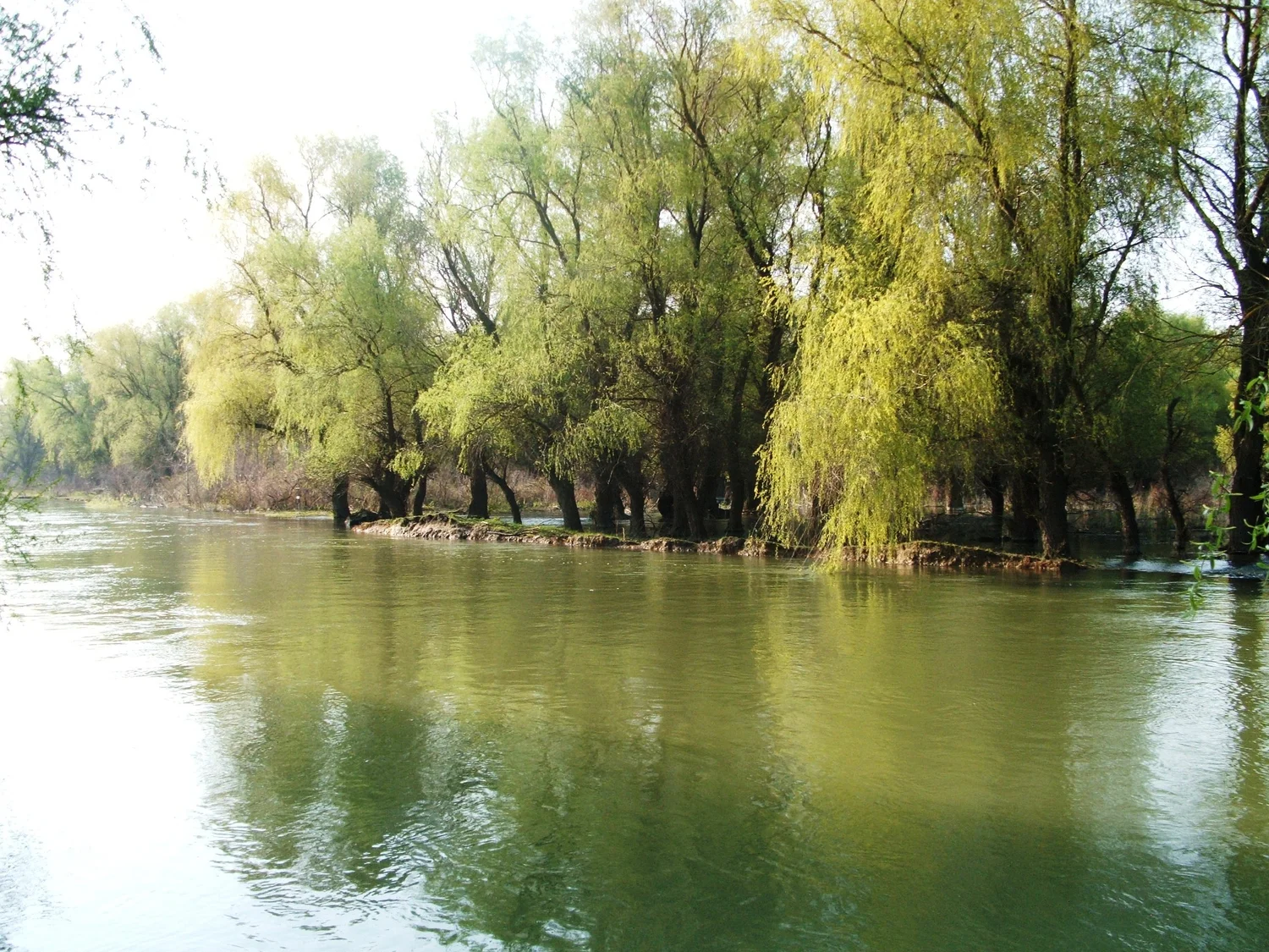
The photograph of a wide channel in the Danube Delta does not announce the point at which the river became several. Its banks are made of familiar things. Trees and vegetation mark one edge. The open water seems quite capable of belonging to a river that had a simple name long before the photograph was taken. To someone looking at a broader map, that confidence can dissolve into a much more interesting question. Which channel is this one, to which other pieces of water is it connected, and what is it able to carry to the sea?
The Danube reaches the Black Sea through a low delta where several different kinds of water space appear together. Chilia, Sulina and Sfântu Gheorghe are large named arms used to describe the system. The IUCN account prepared for the World Heritage nomination locates much of the listed area by reference to these rivers. Those names are useful because they give a big map some anchors. A delta is not exhausted by the principal lines. The difference between drawing those lines and following a particular strand of water is a way to begin understanding the place.
A tributary and a distributary point opposite ways
Think first of an upstream river that takes in two smaller streams. From a map of that part of the system, two lines move toward one. In a delta one part of the story is water leaving a large channel for other routes that can carry it onward. A distributary takes water away from a main channel rather than bringing it in. The contour or arrangement of the map matters because some smaller water bodies can connect in more than one place or under changing conditions. The arrows do not follow from whether a channel was drawn with a narrow or wide blue stroke.
For a small sketch, carry the main Danube in from the west and let a principal arm branch away before drawing the other major paths. Do not make all three branches begin at a single perfect junction simply because the list of names has three items. Use a real map to place the split points. Within the space between two large routes, draw a few much finer lines and mark open water and wet ground where appropriate. The additional detail will seem busier than the first sketch. It also gives room for several different things a user of the delta might mean by “on the river.”
One consequence of the branching is that the full width of a space cannot be understood from one familiar bank. An island or wet strip can be enclosed by channels with very different characteristics. The distance over land to a landmark might be quite small, while the path from one accessible waterway to another follows a long turn around it. Think of a map made for someone arriving along a large arm versus one describing the sequence of water spaces in a wetland. They share the context of a delta. The specific continuation of both journeys depends on information very different from the distance to the coast.
Follow the material as well as the water
A river transports sediment, some of which can settle where local conditions change. Over long periods the deposition and redistribution of material can help build or reshape bodies of land and channels. In a delta empty spaces in a map are not just the places water failed to occupy. The distribution of sediment, the reach of waves or other currents and the supply from the river can affect what becomes emergent ground or stays within the movement of water. A deposit that accumulates at one point can also affect the route available nearby. That is one route by which an apparently settled map can acquire new details.
The process is easier to picture with a small section than with the whole delta. Set a gentle slope into the end of a channel in your drawing. Show deeper water at one point and shallow margins elsewhere. Water and material arriving at those places need not travel at identical speeds or take identical paths. In the wider setting other forces act after the river reaches the sea. A view of an island between courses may show part of the result without dating it or telling you what brought the material there. A more comprehensive account would look for evidence of change across a stated period.
Over long stretches, the geography of the delta also involves things people did. The major channels are not all records solely of sediment and its passage. Routes used in navigation can be maintained or altered, and other human activity has affected water spaces in the delta. The details deserve their own sources. If a channel looks very straight in an aerial view it may be a good place to ask about modification, not sufficient evidence of a particular project. Keep a line in your notes for how a route is now used and another for what you understand of its origin.
The dark green need not be solid ground
UNESCO’s account describes a landscape of wetlands, lakes and habitats associated with the Danube’s approach to the Black Sea. A stretch of wetland can look well defined in an aerial image because of a sharp change in what its surface reflects. From water level, that change can be a fringe of vegetation. Give one color to the area you understand to contain emergent vegetation and another to open water. If a site has a partly exposed surface at one level, mark the conditions or date. The difference between the groups can become much more useful than an overall estimate that it simply looked green.
Think of how this distinction would matter to someone recording a change. A wider pale area in the bottom of a photo taken under different lighting can be the effect of glare rather than a larger lake. The outline can also genuinely change with water level. Other features and dated views can help separate the explanations. In a low landscape, modest changes in level may visibly reach well beyond the edge someone remembered. It is a strong reason to avoid using one picture of the bank as the permanent representation of land.
For a record of wildlife or vegetation, location and access have an additional meaning. Two places marked equally near a major river may have quite different connections to current, depth or regular flooding. A count from a boat in visible water describes what the observers could see from there. It does not automatically represent what happens farther into vegetation. One advantage of reading the main arms together with linked wet areas is that a reader can see how different a pair of plausible observation sites might be.
The map can have several useful boundaries
A basin map follows drainage toward the Danube from far upstream. A delta map can give attention to channels that divide that water and to the places that contain it at the end of the journey. A World Heritage map identifies a particular area with an official boundary for its own purposes. These are not interchangeable ways of deciding where a feature starts. A river can supply a delta from well beyond the frame of its map. A landscape can also continue beyond the scope of a formal designation.
Pick a small stretch of water where an arm reaches the coast and compare a dated shoreline with a map of the protected property. See which lines can be placed with certainty and which merely run near one another. Then compare the position at another scale. The point of the exercise is to learn what fact each boundary could establish. A change in a charted channel might transform somebody’s approach without producing a coincident change in a mapped designation.
A satellite image offers a fourth kind of picture. It can hold the coastline and many channels in one frame, and it can record a collection of surface conditions from one pass. It need not distinguish depth or hidden movement beneath vegetation. Give the image a date and give a description of the water bodies a source. Neither substitutes for the other.
The final line still needs a date
Put the photograph back next to an overview. Identify where the state of the water or the length of a bank can help establish a position. Then give yourself permission to leave the exact location of an unmarked detail undecided. One can describe what kind of place a view shows, where the documented photo broadly belongs and which questions its framing cannot answer. A river in a delta may have clearer names than it has clear boundaries in any one image.
The three large names are a useful way to get oriented again. Follow them toward the Black Sea, then find the relationships farther inland that an outline of the arms has left out. The most revealing thing about the delta may be the space between those lines, the area in which smaller routes, lakes and wet ground give the water other possibilities. A single bank gives the camera something stable to hold. The rest of the map puts that bank back into a system that can continue branching long after the picture ends.